5.0 Perth Catchment: Stewardship and Water Resources Protection
The RVCA and its partners are working to protect and enhance environmental conditions in the Tay River Watershed. Figure 54 shows the location of all stewardship projects completed in the Perth catchment.

5.1 Rural Clean Water
The Rural Clean Water Program provides technical and financial assistance to farmers and other rural landowners, to aid in the implementation of projects that protect water quality. Funding is granted to those projects that support best management practices for application in the protection and improvement of surface and ground water resources. The program also supports climate change adaptation and low impact development projects as well as educating rural landowners about environmental stewardship of private property. Examples of supported projects include livestock exclusion fencing, controlled tile drainage, cover crops, erosion control, well related projects, and many more. For a list of eligible projects and to apply for funding, see Rural Clean Water.
In the Perth catchment from 2011 to 2016, three education initiatives, two well decommissionings, two well upgrades, one septic system repair, one well replacement and one windbreak/buffer were completed; prior to this, four well upgrades, one fuel handling/storage facility, one well replacement, one septic system repair and one livestock fencing project had been completed. When combined, these projects are keeping 1.21 kilograms of Phosphorus out of our rivers and streams each year. Total value of all 18 projects is $58,596 with $13,206 of that amount funded through grant dollars from the RVCA.
5.2 Private Land Forestry
Forest cover and tree planting continues to be one of the most widely supported strategies to improve our environment. The many benefits of forest cover include carbon sequestration, flood mitigation and water quality improvement as well as providing wildlife habitat. For more information about the Program and landowner eligibility, please see the following: Tree Planting in the Rideau Valley Watershed and Trees for Tomorrow.
Thirty butternut trees were planted through the RVCA Butternut Recovery Program in the catchment as part of efforts to introduce healthy seedlings from tolerant butternuts into various locations across Eastern Ontario.
5.3 Shoreline Naturalization
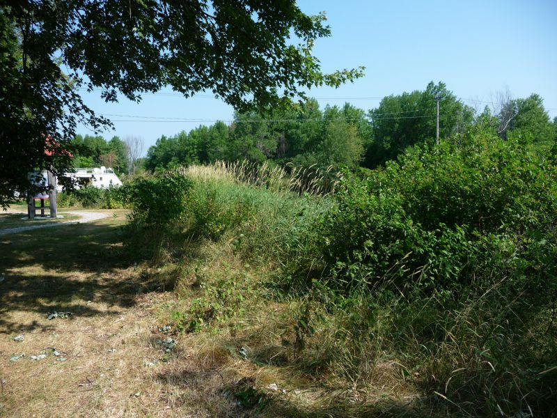
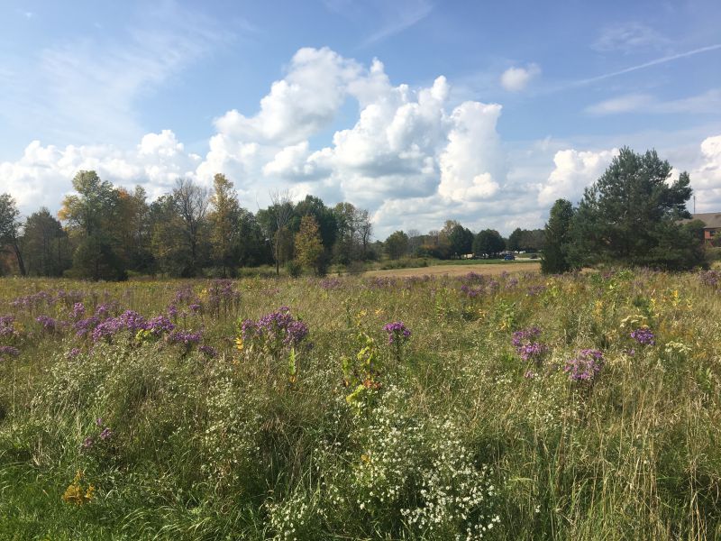
Natural shoreline buffers rich in native plants are critically important to protecting the health of our lakes, rivers and streams. Shoreline vegetation protects water quality and aquatic habitat by intercepting potentially harmful contaminants such as nutrients, pollutants and sediment, regulating water temperatures, slowing runoff and providing important fish and wildlife habitat. Natural shorelines also help improve climate change resiliency by increasing flood storage and providing protection from erosion during extreme weather events.
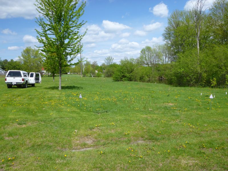
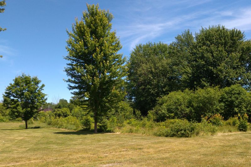
Through the RVCA’s Shoreline Naturalization Program, landowners (private and public property owners) have naturalized more than 2.3 km of shoreline in the Tay Watershed by planting over 10,563 native trees and shrubs at 96 sites since 2008.The total value of these projects is $126,000.
In the Perth catchment up till 2016, a total of 3,405 native trees and shrubs have been planted along 564 metres of shoreline at an average buffer width of eight metres for a total project value of $35,994. Since then, an additional 1,149 trees and shrubs have been planted along 200 metres of shoreline in the Perth catchment at a total value of $12,987.
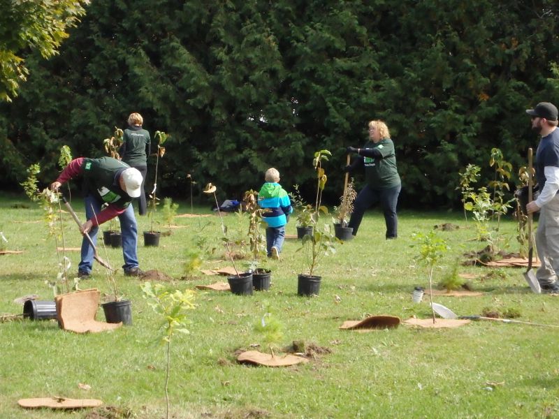
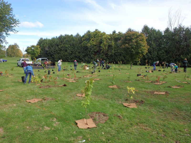
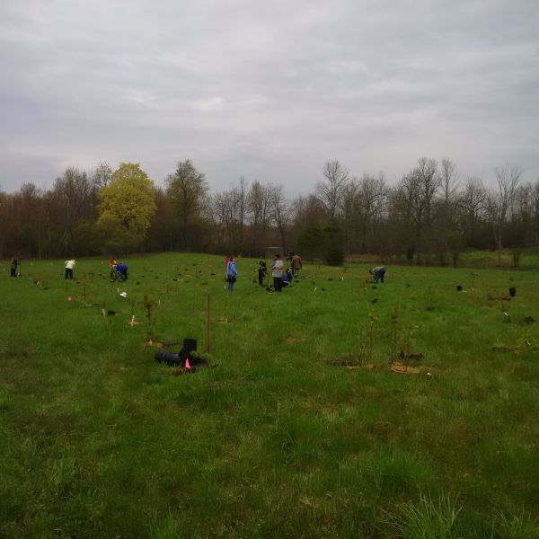
A number of these projects have been undertaken in partnership with community groups (see photos below). In 2009, a naturalized shoreline demonstration site was created along the Tay River within The Town of Perth's Last Duel Park and Campground. In 2013, 45 volunteers assisted with the planting of 1,000 trees and shrubs along the shoreline at the Perth Water Treatment Plant on Sunset Blvd. In 2015, a Toronto Dominion Tree Day volunteer event was also hosted at this property with another 300 trees being planted with help from 20 plus volunteers. In 2017, RVCA partnered with Lanark County and the Lanark Municipal Trail Corporation to naturalize 12,000 square metres of idle land along the new Tay River Trail Pathway extension behind the Lanark Lodge and the Perth Community Care Centre on Christie Lake Road. Again, more than 20 community members volunteered their time to help plant over 1100 native trees and shrubs.

5.4 Fish Habitat Improvement
Tay and Little Tay River Rocky Ramps
Two rocky ramps were constructed on the Tay river (Stewart Park side channel in 2015; main stem in 2017) to replace existing structures that were in operational disrepair and causing a number of problems for residents of the Town of Perth, including flooding of Stewart Park throughout the year, erosion of the Tay River banks, degradation of gabion baskets and damage to the flow structure in Stewart Park.
The main goal of the works was to restore the 80/20 flow patterns (split) in the volume of water conveyed along the main stem of the Tay River versus that moving through the Little Tay River in Stewart Park during summer conditions. Specific design elements/enhancements built into the two new structures that were not present in the former structures include:
- A fishway including step-pool sequencing
- Walleye spawning material veneer in pools
- Improved flow connectivity around an existing bend in the Tay River
- Embedded large stones to mitigate ice flows into Stewart Park
- Grading/fill to improve connectivity and remove organic laden dead zone
- Low flow notch located to increase water velocities and encourage nutrient transport downstream
- Naturalisation of the area to remove the hard structure of the former dam
Construction of the rocky ramps represents a significant cost saving to taxpayers estimated to be around $735,500 ($1.6 million for 2 concrete dams vs. $300,000 for 2 rocky ramps).
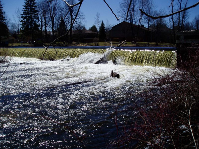 Tay River (main stem) Haggart Island dam in the Town of Perth (2007)
of Perth r") Tay River (main stem) rocky ramp installation in the Town of Perth (2017)
Tay River (main stem) rocky ramp installation in the Town of Perth (2017)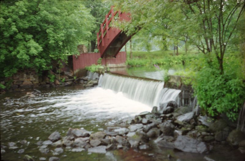 Tay River (Stewart Park side channel) Haggart Island dam in the Town of Perth (2007)
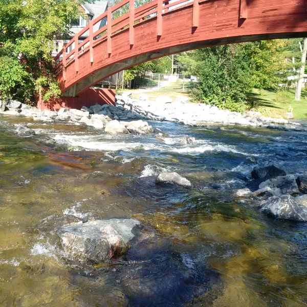 Tay River (Stewart Park side channel) rocky ramp installation in the Town of Perth (2015)
Funding for the two restoration projects was supplemented through a multi-party partnership between the Friends of the Tay Watershed Association, the RVCA and the Town of Perth. Friends of the Tay applied to the DFO Canada Recreational Fisheries Conservation Partnership Program and was the recipient of $90,000 in funding to assist with the installation of the Tay River rocky ramp structure.
5.5 Water Treatment
Drinking Water in the Town of Perth
The Town of Perth addressed the treatment of Process Water (organic and inorganic material returned to the Tay River) with the implementation of geotube bags. Process water is water that is laden with leaves, silt, clays, and other materials that are suspended in solution from the flocculation and filtering processes used in preparing drinking water. This material was traditionally returned to the Tay River downstream of the Water Treatment Plant intake.
Following a successful field trial and Environmental Assessment, the municipality advanced the implementation of the geotube back technology (Bishop Water Technologies- Eganville, ON) to remove solids from the discharged water. The processes involved the re-routing of process water into large porous geotextile bags that allow water to weep through the surface of the bag while retaining the solids inside the vessel. The three (3) large geotube bags are alternated daily to allow the solids enough time to dewater and consolidate throughout the seasons. One (1) of the bags is placed in a large greenhouse to allow filtering process to continue during freezing temperatures.
The municipality meets the guidelines of 15mg/l of Total Suspended Solids in the discharged water that returns to the Tay river. Since 2015 approximately 550 tonnes of solids are captured annually within the geotube system. This material is harvested from each of the geotube bags and transported to the Perth Landfill Site and used for daily cover of waste.
Sanitary in the Town of Perth
The Town of Perth completed the installation of the SAGR system (Submerged Attached Growth Reactor) at the Perth Wastewater Treatment Facility to address treatment capacity for the municipality. The SAGR (Nexom- Winnipeg, MB) is a biological process that involves aerated submerged beds that promote biological action that reduces E-coli, ammonia, and suspended solids from the wastewater discharged from the former lagoon system. Following a successful field trial in partnership with the Federation of Canadian Municipalities, the municipality constructed four (4) SAGR beds to increase treatment levels and develop capacity in Perth.
The SAGR system uses naturally-occurring biological processes that thrive in contained rock beds that are fed by air blowers to promote the breakdown of contaminates in sewage waste. The beds are fed liquid waste from the three (3) cell lagoon system and act to polish the waste before it is deposited into the Tay River. The system is designed to treat the wastewater generated from the equivalent population of 8200 people. As the population increases, the municipality can add one (1) further SAGR bed to a population of 10,500 people.
The SAGR has shown great successes with dramatic reductions of E-coli, ammonia, and suspended solids during operations in 2018 and 2019. The reductions in the system is equivalent or better than fully mechanized facilities without the use of chemicals, high energy costs, or mechanical systems.
Stormwater in the Town of Perth
The Town of Perth has been successful at securing a Small Communities Fund grant for the treatment of stormwater and the segregation of clean (rainwater, sump pump, and cooling water) from the sanitary sewer systems that have traditionally been routed into the sanitary sewer system. Though these water sources are being treated, the seasonal impacts on the sanitary sewer system has negatively impacted development capacity for Perth.
Perth has procured a Canadian product known as a CB Shield that inserts into catchbasins to reduce the velocity of stormwater and allow solids to be captured more effectively within the structure. Traditional large stormwater treatment systems require large acreage, designs, and approvals and the CB Shield is a drop-in unit that has the equivalent treatment capacity without the limitations of traditional treatment alternatives.
Perth will be installing approximately 120 treatment units at four (4) sub-watersheds directly depositing rainwater into the Tay River. The installation of these units will be installed in October/November prior to the frost/snow season to allow the treatment of stormwater early in 2020.
The additional challenge with Perth’s storm sewer system is the deposition of “clean” water from homes and businesses that direct sump pump water, roof drains, and cooling water into the sanitary sewer system. The placement of this type of water negatively affects the development capacity of Perth by increasing the annual volume of wastewater being treated at the Perth Wastewater Treatment facility. Perth was successful at implementing a new Sewer Use By-law and Sump Pump Disconnect program in 2019 to facilitate the reduction of water being placed in the sanitary sewer network. This program will financially assist homeowners by redirecting plumbing systems to the storm sewer, lawns, rain barrels, or infiltration beds to better address this volume of water in two (2) designated subdivisions in Perth.
5.5 Valley, Stream, Wetland and Hazard Lands
Perth Catchment Natural Hazards
The Perth catchment covers 21.4 square kilometres with 7.6 square kilometres (or 35.6 percent) of the drainage area being within the regulation limit of Ontario Regulation 174/06 (Figure 55), giving protection to wetland areas and river or stream valleys that are affected by flooding and erosion hazards.
Wetlands occupy seven square kilometres (or 32 percent) of the Perth catchment. Of these wetlands, four square kilometres (or 57 percent) are designated as provincially significant and included within the RVCA regulation limit. This leaves the remaining three square kilometres (or 47 percent) of wetlands in the catchment outside the regulated area limit.
Of the 35.1 kilometres of stream in the Perth catchment, regulation limit mapping has been plotted along 21.1 kilometers of streams (representing 60 percent of all streams in the catchment). Some of these regulated streams (10.2 km) flow through regulated wetlands; the remaining 10.9 kilometres of regulated streams are located outside of those wetlands. Plotting of the regulation limit on the remaining 14 kilometres (or 40 percent) of streams requires identification of flood and erosion hazards and valley systems.

Town of Perth Natural Hazards
The Town of Perth catchment covers 12.2 square kilometres with 5.4 square kilometres (or 44.3 percent) of the municipality being within the regulation limit of Ontario Regulation 174/06 (Figure 56), giving protection to wetland areas and river or stream valleys that are affected by flooding and erosion hazards.
Wetlands occupy 3.2 square kilometres (or 26 percent) of the Town of Perth. Of these wetlands, 2.8 square kilometres (or 86 percent) are designated as provincially significant and included within the RVCA regulation limit. This leaves the remaining 0.4 square kilometres (or 14 percent) of wetlands in the catchment outside the regulated area limit.
Of the 19.9 kilometres of stream (including the Tay River) in the Town of Perth, regulation limit mapping has been plotted along 18.1 kilometers of streams (representing 91 percent of all streams in the municipality). Some of these regulated streams (9.1 km) flow through regulated wetlands; the remaining 9.0 kilometres of regulated streams are located outside of those wetlands. Plotting of the regulation limit on the remaining 1.8 kilometres (or 9 percent) of streams requires identification of flood and erosion hazards and valley systems.

Within those areas of the Perth catchment (Figure 55) and the Town of Perth (Figure 56) subject to the regulation (limit), efforts (have been made and) continue through RVCA planning and regulations input and review to manage the impact of development (and other land management practices) in areas where “natural hazards” are associated with rivers, streams, valley lands and wetlands. Additionally, in areas of the Town of Perth where new development is planned (for the former golf course lands and annexed lands north of Dufferin St.), significant effort is made through land use planning and development control processes and carefully planned stormwater management systems, initially guided by master drainage planning and integrated subwatershed planning, to address the natural heritage, natural hazards and source/water quality policies presented in the Town of Perth Official Plan. Also, within areas beyond the regulation limit, protection of the catchment’s watercourses is provided through the “alteration to waterways” provision of the RVCA regulation.
5.6 Vulnerable Drinking Water Areas
The Town of Perth’s municipal drinking water Intake Protection Zone (IPZ), specifically IPZ-1 and 2 with vulnerability scores of 8, 9 and 10 are found within the Perth catchment (Figures 55, 56). As per the Mississippi-Rideau Source Protection Plan, policies may affect future development within these areas. Under Section 59 of the Clean Water Act, 2006, future applications under the Building Code and the Planning Act may be screened by the Mississippi-Rideau Risk Management Office. Depending on the proposed activity, additional requirements or restrictions may apply. For more information, please contact the Mississippi-Rideau Risk Management Office at (613) 692-3571.
In addition, the Mississippi-Rideau Source Protection Plan has mapped a small area of the Perth catchment as within a Significant Groundwater Recharge Area and identified all of the catchment as a Highly Vulnerable Aquifer. This means that the nature of the overburden (thin soils, fractured bedrock) does not provide a high level of protection for the underlying groundwater making the aquifer more vulnerable to contaminants released on the surface. Highly Vulnerable Aquifers characterise 89% of the Region and are considered moderate to low drinking water threats with certain policies that apply; mainly policies regarding waste disposal. All property owners are encouraged to use best management practices to protect sources of municipal drinking water. For more information on source protection best management practices, please visit Protecting Your Drinking Water.