Full Catchment Report
Middle Rideau Subwatershed Report 2015
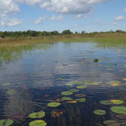
IRISH CREEK CATCHMENT
The RVCA produces individual reports for ten catchments in the Middle Rideau subwatershed. Using data collected and analysed by the RVCA through its watershed monitoring and land cover classification programs, surface water quality conditions are reported for Irish Creek along with a summary of environmental conditions for the surrounding countryside every six years.
This information is used to better understand the effects of human activity on our water resources, allows us to better track environmental change over time and helps focus watershed management actions where they are needed the most to help sustain the ecosystem services (cultural, aesthetic and recreational values; provisioning of food, fuel and clean water; regulation of erosion/natural hazard protection and water purification; supporting nutrient/water cycling and habitat provision) provided by the catchment’s lands and forests and waters (Millennium Ecosystem Assessment 2005).
The following pages of this report are a compilation of that work and contain information on surface water quality, riparian conditions, land cover, stewardship activity and hazard land and water resources protection.
Surface water quality conditions in the Irish Creek catchment are monitored by the Rideau Valley Conservation Authority’s (RVCA) Baseline Water Quality Monitoring Program. The Baseline Water Quality Program focuses on streams; data is collected for 22 parameters including nutrients (total phosphorus, total Kjeldahl nitrogen and ammonia), E. coli, metals (like aluminum and copper) and additional chemical/physical parameters (such as alkalinity, chlorides, pH and total suspended solids). Figure 1 shows the location of the monitoring site in the catchment.

The water quality rating for the Irish Creek catchment is “Good” (Table 1) as determined by the Canadian Council of Ministers of the Environment (CCME) Water Quality Index and is largely influenced by occasionaly high nutrient concentrations and bacterial counts. A "Good" rating indicates water quality is protected with only a minor degree of threat or impairment; conditions rarely depart from natural or desireable levels. Each parameter is evaluated against established guidelines to determine water quality conditions. Those parameters that frequently exceed guidelines are presented below. Analysis of the data has been broken into two periods; 2003 to 2008 and 2009 to 2014 for the stream monitoring site located on Irish Creek (IRI-02) to examine if conditions have changed between these periods. Table 1 shows the overall rating for the monitored surface water quality site within the Irish Creek catchment and Table 2 outlines the Water Quality Index (WQI) scores and their corresponding ratings.
| Sampling Site | Location | 2003-2008 | Rating |
|---|---|---|---|
| IRI-02 | Irish Creek at County Rd. 16 | 76 | Fair |
| Sampling Site | Location | 2009-2014 | Rating |
| IRI-02 | Irish Creek at County Rd. 16 | 86 | Good |
| Rating | Index Score |
|---|---|
| Very Good (Excellent) | 95-100 |
| Good | 80-94 |
| Fair | 65-79 |
| Poor (Marginal) | 45-64 |
| Very Poor (Poor) | 0-44 |
Total phosphorus (TP) is used as a primary indicator of excessive nutrient loading and may contribute to abundant aquatic vegetation growth and depleted dissolved oxygen levels. The Provincial Water Quality Objective (PWQO) is used as the TP Guideline and states that in streams concentrations greater than 0.030 mg/l indicate an excessive amount of TP.
Total Kjeldahl nitrogen (TKN) and ammonia (NH3) are used as secondary indicators of nutrient loadings. RVCA uses a guideline of 0.500 mg/l to assess TKN[1] and the PWQO of 0.020 mg/l to assess NH3 concentrations in Dales Creek.
Tables 3, 4 and 5 summarize average nutrient concentrations at monitored sites within the Creek catchment and show the proportion of results that meet the guidelines.
| Total Phosphorous 2003-2008 | |||
|---|---|---|---|
| Site | Average | Below Guideline | No. Samples |
| IRI-02 | 0.019 | 95% | 42 |
| Total Phosphorous 2009-2014 | |||
| Site | Average | Below Guideline | No. Samples |
| IRI-02 | 0.014 | 100% | 37 |
| Total Kjeldahl Nitrogen 2003-2008 | |||
|---|---|---|---|
| Site | Average | Below Guideline | No. Samples |
| IRI-02 | 0.669 | 24% | 42 |
| Total Kjeldahl Nitrogen 2009-2014 | |||
| Site | Average | Below Guideline | No. Samples |
| IRI-02 | 0.608 | 22% | 37 |
| Ammonia 2003-2008 | |||
|---|---|---|---|
| Site | Average | Below Guideline | No. Samples |
| IRI-02 | 0.017 | 83% | 12 |
| Ammonia 2009-2014 | |||
| Site | Average | Below Guideline | No. Samples |
| IRI-02 | 0.008 | 83% | 12 |
Elevated TP results rarely exceeded the guideline in the 2003-2008 and 2009-2014 monitoring periods at site IRI-02. The 2009-2014 monitoring period saw an improvement with no exceedances. Site IRI-02 had 95 percent of samples that were below the guideline in the 2003-2008 period (Figure 2); this increased to 100 percent of samples in the 2009-2014 period (Figure 3). The average TP concentration for both reporting periods were below the PWQO which slightly decreased from 0.019 mg/l to 0.014 mg/l (Table 3).


TKN concentrations show that the bulk of results exceeded the guideline (Figures 4 and 5). There were few samples (24 percent) below the guideline in the 2003-2008 period and this slightly decreased to 22 percent in the 2009-2014 period. The average concentration was generally elevated and decreased from 0.669 mg/l to 0.608 mg/l (Table 8).


Occasional elevated nutrients were observed in NH3 data. The proportion of results that were below the guideline were 83 percent for both monitoring periods (Figures 6 and 7). The average NH3 concentration from 2003-2008 was 0.017 mg/l and decreased to 0.008 mg/l from 2009-2014. Both averages were below the guideline. (Table 5).


The data shows that nutrient enrichment is an occasional feature of Irish Creek. All nutrients decreased between the two reporting periods, with a majority of samples below the guidelines for both TP and NH3. Elevated TKN results were observed during both monitoring periods and have average concentrations that exceed the guidelines. These elevated results may be influenced by organic matter held by wetland areas found upstream in the Middle Rideau Subwatershed, resulting in naturally high concentrations of organic nitrogen. High nutrient concentrations can help stimulate the growth of algae blooms and other aquatic vegetation in a waterbody and deplete oxygen levels as the vegetation dies off. It is important to reduce human impacts wherever possible. Strategies to reduce nutrient inputs may include diversion of runoff to the creek and enhanced shoreline buffers.
E. coli is used as an indicator of bacterial pollution from human or animal waste; in elevated concentrations it can pose a risk to human health. The PWQO of 100 colony forming units/100 millilitres (CFU/100 ml) is used. E. coli counts greater than this guideline indicate that bacterial contamination may be a problem within a waterbody.
Table 6 summarizes the geometric mean[2] for the monitored site on Irish Creek and shows the proportion of samples that meet the E. coli guideline of 100 CFU/100 ml. The results of the geometric mean with respect to the guideline for the two periods, 2003-2008 and 2009- 2014, are shown in Figures 8 and 9 respectively.
| E.coli 2003-2008 | |||
|---|---|---|---|
| Site | Geometric Mean (CFU/100ml) | Below Guideline | No. Samples |
| IRI-02 | 38 | 90% | 42 |
| E.coli 2009-2014 | |||
| Site | Geometric Mean (CFU/100ml) | Below Guideline | No. Samples |
| IRI-02 | 25 | 95% | 37 |
E. coli results at site IRI-02 indicate bacterial counts are rarely above the E. coli guideline. The proportion of samples below the guideline increased from 90 percent (Figure 8) to 95 percent (Figure 9). E.coli counts decreased between the two monitoring periods (2003-2008 and 2009-2014) with a geometric mean of 38 CFU/100ml to 25 CFU/100ml (Table 6).


This data shows that E.coli results rarely exceed the guidelines at site IRI-02 in Irish Creek. The geometric mean is below the PWQO for both monitoring periods and there has been a decrease in E.coli counts between 2003-2008 and 2009-2014. Properly maintaining septic systems, enhancing shoreline buffers and restricting cattle access can help to improve and maintain E.coli levels in Irish Creek.
[1] No Ontario guideline for TKN is presently available; however, waters not influenced by excessive organic inputs typically range from 0.100 to 0.500 mg/l, Environment Canada (1979) Water Quality Sourcebook, A Guide to Water Quality Parameters, Inland Waters Directorate, Water Quality Branch, Ottawa, Canada
[2] A type of mean or average, which indicates the central tendency or typical value of a set of numbers by using the product of their values (as opposed to the arithmetic mean which uses their sum). It is often used to summarize a variable that varies over several orders of magnitude, such as E. coli counts.
![]()
The RVCA is part of the provincial Watershed Checkup Program.