5.0 Monahan Drain Catchment: Stewardship and Water Resources Protection
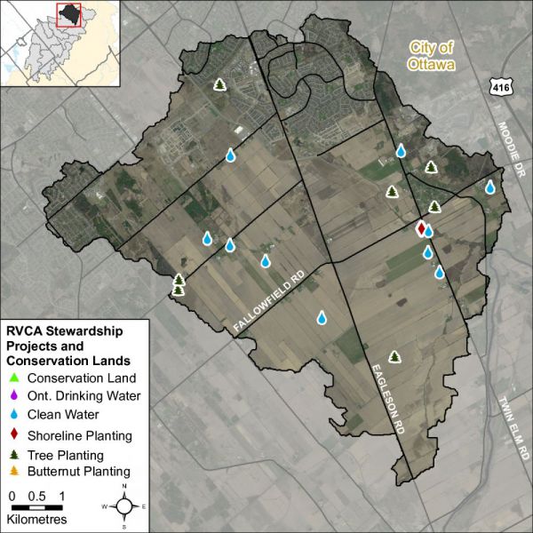
The RVCA and its partners are working to protect and enhance environmental conditions in the Jock River Subwatershed. Figure 25 shows the location of all stewardship projects completed in the Monahan Drain catchment along with sites identified for potential shoreline restoration.
5.1 Rural Clean Water Projects
From 2010 to 2015, two clean water diversions, one windbreak buffer, one well decommissioning and one manure storage/wastewater runoff project were completed. Between 2004 and 2009, two septic system replacements, one well decommissioning, one well replacement and one well upgrade were completed. Prior to 2004, five crop residue projects and one livestock fencing were completed. Total value of all 16 projects is $336,954 with $34,463 of that amount funded through grant dollars from the RVCA.
5.2 Private Land Forestry Projects
The location of RVCA tree planting projects is shown in Figure 25. From 2010 to 2015, 13,350 trees were planted at two sites. Between 2004 and 2009, 6000 trees were planted at three sites. No trees were planted in the catchment prior to 2004, In total, 19,350 trees were planted, resulting in the reforestation of 10 hectares. Total value of all five projects is $100,739 with $34,607 of that amount coming from various fundraising sources.
5.3 Shoreline Naturalization Projects
With the assistance of the RVCA’s Shoreline Naturalization Program, 234 trees and shrubs were planted to create a 77 metre long shoreline buffer along the Monahan Drain at a total project value of $4,004.
5.4 Valley, Stream, Wetland and Hazard Lands
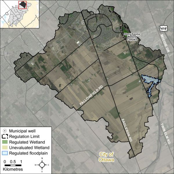
The Monahan Drain catchment covers 45 square kilometres with 1 square kilometre (or two percent) of the drainage area being within the regulation limit of Ontario Regulation 174/06 (Figure 26), giving protection to wetland areas and river or stream valleys that are affected by flooding and erosion hazards.
Wetlands occupy 12.5 ha. (or less than one percent) of the catchment, all of which are designated as provincially significant and included within the RVCA regulation limit.
Of the 97.2 kilometres of stream in the catchment, regulation limit mapping has been plotted along 4.2 kilometers of streams (representing four percent of all streams in the catchment). Plotting of the regulation limit on the remaining 93 km (or 96 percent) of streams requires identification of flood and erosion hazards and valley systems.
Within those areas of the Monahan Drain catchment subject to the RVCA regulation (limit), efforts (have been made and) continue through RVCA planning and regulations input and review to manage the impact of development (and other land management practices) in areas where “natural hazards” are associated with rivers, streams, valley lands and wetlands. Additionally, in the rapidly urbanizing areas of Kanata South within the Monahan Drain catchment , significant effort is made through land use planning and development control processes and carefully planned stormwater management systems, initially guided by master drainage planning and integrated subwatershed planning, to meet the natural heritage and natural hazards policies presented in the City of Ottawa Official Plan. Also, within areas beyond the regulation limit, protection of the catchment’s watercourses is provided through the “alteration to waterways” provision of the regulation.

