2.0 Blueberry Creek Catchment: Surface Water Quality Conditions
Surface water quality conditions in the Blueberry Creek catchment are monitored by the Rideau Valley Conservation Authority's Baseline Water Quality Monitoring Program. This program provides information on the condition of tributaries and the Tay River within the Tay River watershed. Data is collected for multiple parameters including nutrients (total phosphorus and total Kjeldahl nitrogen ), E. coli, metals (like aluminum and copper) and additional chemical/physical parameters (such as alkalinity, chlorides, pH and total suspended solids). The locations of monitoring sites are shown in Figure 2 and Table 1.
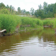
Figure 2 Water quality monitoring site on Blueberry Creek in the Blueberry Creek Catchment
2.1 Blueberry Creek: Water Quality Rating
There is one monitored water quality site on Blueberry Creek in the Blueberry Creek Catchment (BLU-01), the RVCA's water quality rating for this site ranges from “Fair” to “Good”, this is based on the range of ratings calculated at three year intervals from 2012-2017 (Table 1) as determined by the Canadian Council of Ministers of the Environment (CCME) Water Quality Index. The WQI and corresponding ratings are presented in Table 2. A “Fair” rating indicates that water quality is usually protected but is occasionally threatened or impaired; conditions sometimes depart from natural or desirable levels. While “Good” indicates water quality is protected with only a minor degree of threat or impairment; conditions rarely depart from natural or desirable levels. Each parameter is evaluated against established guidelines to determine water quality conditions. Those parameters that frequently exceed guidelines are presented below. The data has been examined through the period of record to determine if conditions have changed.
The scores at this site are largely influenced by frequent high nutrient concentrations and occasional metal exceedances. For more information on the WQI please see the Tay River Subwatershed Report.
Table 1 Water Quality Index ratings for the Blueberry Creek Catchment
Table 2 Water Quality Index ratings and corresponding index scores (RVCA terminology, original WQI category names in brackets)
2.1.2 Blueberry Creek: Nutrients
Total phosphorus (TP) is used as a primary indicator of excessive nutrient loading and may contribute to abundant aquatic vegetation growth and depleted dissolved oxygen levels. The Provincial Water Quality Objective (PWQO) is used as the TP Guideline and states that in streams concentrations greater than 0.030 mg/l indicate an excessive amount of TP.
Total Kjeldahl nitrogen (TKN) is used as a secondary indicator of nutrient loading. RVCA uses a guideline of 0.500 mg/l to assess TKN[1].
Tables 3 and 4 summarize average nutrient concentrations at the monitored site within the Blueberry Creek catchment and show the proportion of results that meet the guidelines.
Table 3 Summary of total phosphorus results for the Blueberry Creek Catchment, 2012-2017
Table 4 Summary of total Kjeldahl nitrogen results for the Blueberry Creek Catchment, 2012-2017 (Highlighted values indicate average concentrations exceed the guideline)
Monitoring Site BLU-01
Elevated TP results occurred occasionally at site BLU-01 throughout the monitoring period; about 61% of samples were below the guideline (Figure 4) though average concentrations generally exceed the guidelines during the summer months (Figure 3). The average TP concentration was just below the guideline of 0.030 mg/l at 0.029 mg/l (Table 3).
The majority of TKN results have exceeded the guideline (Figure 5), with only three percent of samples below the guideline. The average concentration was 0.936 mg/l and exceeded the guideline of 0.500 mg/l (Table 4).
There was no significant change[2] in the sampled concentrations of TP or TKN in Blueberry creek over the 2012-2017 period (Figure 4 and 6).
Figure 3 Average monthly total phosphorus concentrations in Blueberry Creek, 2012-2017.
Figure 4 Distribution of total phosphorus concentrations in Blueberry Creek, 2012-2017.
Figure 5 Average monthly total Kjeldahl nitrogen concentrations in Blueberry Creek, 2012-2017.
Figure 6 Distribution of total Kjeldahl nitrogen concentrations in Blueberry Creek, 2012-2017
Summary of Blueberry Creek Nutrients
This portion of Blueberry Creek can be identified as nutrient enriched. Overall, average nutrient concentrations have remained consistent through the monitoring period. Both parameters (total phosphorus, total Kjeldahl nitrogen and ammonia) have concentrations that exceed their respective guidelines and average concentrations are approaching or exceed guidelines. Elevated nutrients may result in nutrient loading downstream to the Tay River. High nutrient concentrations can help stimulate the growth of algae blooms and other aquatic vegetation in a waterbody and deplete oxygen levels as the vegetation dies off. It should be noted that this creek is fed by the extensive Blueberry Marsh; this wetland complex is naturally nutrient rich and is likely the largest contributor to elevated nutrient conditions. Best management practices such as minimizing storm water runoff, enhanced shoreline buffers, minimizing/discontinuing the use of fertilizers and restricting livestock access in both surrounding agricultural and developed areas can help to reduce additional nutrient enrichment both within this creek, as well as the Tay River.
2.1.3 Blueberry Creek: E. coli
Escherichia coli (E. coli) is used as an indicator of bacterial pollution from human or animal waste; in elevated concentrations it can pose a risk to human health. The PWQO of 100 colony forming units/100 millilitres (CFU/100 ml) is used as a guideline. E. coli counts greater than this guideline indicate that bacterial contamination may be a problem within a waterbody.
Table 5 summarizes the geometric mean[3] for the monitored site on Blueberry Creek and shows the proportion of samples that meet the E. coli guideline of 100 CFU/100 ml. The results of the geometric mean with respect to the guideline for the 2012-2017 period are shown in Figures 7 and 8.
Table 5 Summary of
E. coli results for Blueberry Creek, 2012-2017
Monitoring Site BLU-01
E. coli counts at site BLU-01 show that there has been no significant trend in bacterial counts (Figure 8). The count at the geometric mean was 65 (Table 5), and majority of results (68 percent) were below the E. coli guideline. Figure 7 shows that periods of elevated counts have occurred; this is observed during the summer months and may be attributed to warm weather and low flow conditions.
Figure 7 Geometric mean of monthly E. coli counts in Blueberry Creek, 2012-2017
Figure 8 Distribution of E. coli counts in Blueberry Creek, 2012-2017
Summary of Blueberry Creek Bacterial Contamination
Bacterial contamination does not appear to be a significant concern in this reach of the Blueberry Creek. As indicated by Figure 8 occasional exceedances above the guideline of 100 CFU/100ml have been observed. Best management practices such as enhancing shoreline buffers, limiting livestock access and minimizing runoff in both rural and developed areas can help to protect this reach of the Blueberry Creek into the future.
2.1.4 Blueberry Creek: Metals
Of the metals routinely monitored in Blueberry Creek (Blueberry Creek Catchment) aluminum (Al) occasionally reported concentrations above its respective Provincial Water Quality Objective, which is 0.075 mg/l. In elevated concentrations, these metals can have toxic effects on sensitive aquatic species.
Table 6 summarizes Al concentrations at site BLU-01 as well as show the proportion of samples that meet guidelines. Figures 9 and 10 show metal concentrations with respect to the guidelines for the monitoring period, 2012-2017.
Table 6 Summary of aluminum results in Blueberry Creek from 2012-2017.
Monitoring Site BLU-01
The average Al concentrations in site BLU-01 was 0.069 mg/l and did not exceed the guideline (PWQO). Fifty percent of samples were below the guideline and there was no significant change in Al concentrations across the monitoring period (Table 6, Figure 10). Please note that metal concentrations are only monitored at this site twice per year, once during high flows in April and the second during the low flow period in August. The elevated concentrations in August may be a result of groundwater contributions, leaching from stream sediments, or concentrated conditions during periods of minimal stream flow.
Figure 9 Average monthly aluminum concentrations in Blueberry Creek, 2012-2017.
Figure 10 Distribution of aluminum concentrations in Blueberry Creek, 2012-2017.
Summary of Blueberry Creek Metals
In the Blueberry Creek Catchment there is little evidence of increased metal concentration above respectve guidelines. Continued efforts should be made to protect against possible pollution sources and implement best management practices to reduce any inputs such as storm water runoff from hardened surfaces to improve overall stream health and lessen downstream impacts to the Tay River.
1 No Ontario guideline for TKN is presently available; however, waters not influenced by excessive organic inputs typically range from 0.100 to 0.500 mg/l, Environment Canada (1979) Water Quality Sourcebook, A Guide to Water Quality Parameters, Inland Waters Directorate, Water Quality Branch, Ottawa, Canada.
2 The evaulations of temporal trends or significant change over time in the data set was preformed using the Mann Kendall trend test and Sens slope estimator, a confidence levels of p<0.05 was used to determine if trends were significant.
3 A type of mean or average, which indicates the central tendency or typical value of a set of numbers by using the product of their values (as opposed to the arithmetic mean which uses their sum). It is often used to summarize a variable that varies over several orders of magnitude, such as E. coli counts.